Get Spatial Data from Soil Data Access by mukey, nationalmusym or areasymbol
Source: R/fetchSDA_spatial.R
fetchSDA_spatial.RdThis method facilitates queries to Soil Data Access (SDA) mapunit and survey area geometry. Queries are generated based on map unit key (mukey) and national map unit symbol (nationalmusym) for mupolygon (SSURGO) or gsmmupolygon (STATSGO) geometry OR legend key (lkey) and area symbols (areasymbol) for sapolygon (Soil Survey Area; SSA) geometry).
A Soil Data Access query returns geometry and key identifying information about the map unit or area of interest. Additional columns from the map unit or legend table can be included; see add.fields argument.
Usage
fetchSDA_spatial(
  x,
  by.col = "mukey",
  method = "feature",
  geom.src = "mupolygon",
  db = "SSURGO",
  add.fields = NULL,
  chunk.size = 10,
  verbose = TRUE,
  as_Spatial = getOption("soilDB.return_Spatial", default = FALSE)
)
Arguments
- x
A vector of map unit keys (
mukey) or national map unit symbols (nationalmusym) formupolygon,mulineormupoint; feature keys (featkey) forfeatpointandfeatline; legend keys (lkey) or soil survey area symbols (areasymbol) forsapolygongeometry. Ifgeom.src="mlrapolygon"thenxrefers toMLRARSYM(major land resource area symbols).- by.col
Column name containing map unit identifier
"mukey","nationalmusym", or"ecoclassid"forgeom.srcmupolygonOR"areasymbol","areaname","mlraoffice","mouagncyresp"forgeom.srcsapolygon; default is determined byisTRUE(is.numeric(x))formukey,featkeyorlkey, usingnationalmusymorareasymbolotherwise.- method
geometry result type:
"feature"returns polygons,"bbox"returns the bounding box of each polygon (viaSTEnvelope()),"point"returns a single point (viaSTPointOnSurface()) within each polygon,"extent"returns an aggregate bounding box (the extent of all polygons,geometry::EnvelopeAggregate()) ),"convexhull"(geometry::ConvexHullAggregate()) returns the aggregate convex hull around all polygons,"union"(geometry::UnionAggregate()) and"collection"(geometry::CollectionAggregate()) return aMULTIPOLYGONor aGEOMETRYCOLLECTION, respectively, for eachmukey,nationalmusym, orareasymbol. In the case of the latter four aggregation methods, the groups for aggregation depend onby.col(default by"mukey").- geom.src
Either
mupolygon(map unit polygons),muline(map unit lines),mupoint(map unit points),featpoint(feature points),featline(feature lines),sapolygon(soil survey area boundary polygons), ormlrapolygon(major land resource area boundary polygons)- db
Default:
"SSURGO". Whengeom.srcismupolygon, use STATSGO polygon geometry instead of SSURGO by settingdb = "STATSGO"- add.fields
Column names from
mapunitorlegendtable to add to result. Must specify parent table name as the prefix before column name e.g.mapunit.muname.- chunk.size
Number of values of
xto process per query. Necessary for large results. Default:10- verbose
Print messages?
- as_Spatial
Return sp classes? e.g.
Spatial*DataFrame. Default:FALSE.
Value
an sf data.frame corresponding to SDA spatial data for all symbols requested. If as_Spatial=TRUE returns a Spatial*DataFrame from the sp package via sf::as_Spatial() for backward compatibility. Default result contains geometry with attribute table containing unique feature ID, symbol and area symbol plus additional fields in result specified with add.fields.
Details
This function automatically "chunks" the input vector (using makeChunks()) of map unit identifiers to minimize the likelihood of exceeding the SDA data request size. The number of chunks varies with the chunk.size setting and the length of your input vector. If you are working with many map units and/or large extents, you may need to decrease this number in order to have more chunks.
Querying regions with complex mapping may require smaller chunk.size. Numerically adjacent IDs in the input vector may share common qualities (say, all from same soil survey area or region) which could cause specific chunks to perform "poorly" (slow or error) no matter what the chunk size is. Shuffling the order of the inputs using sample() may help to eliminate problems related to this, depending on how you obtained your set of MUKEY/nationalmusym to query. One could feasibly use muacres as a heuristic to adjust for total acreage within chunks.
Note that STATSGO data are fetched where CLIPAREASYMBOL = 'US' to avoid duplicating state and national subsets of the geometry.
A prototype interface, geom.src="mlrapolygon", is provided for obtaining Major Land Resource Area (MLRA) polygon
boundaries. When using this geometry source x is a vector of MLRARSYM (MLRA Symbols). The geometry source is
the MLRA Geographic Database v5.2 (2022) which is not (yet) part of Soil Data Access. Instead of SDA, GDAL utilities
are used to read a zipped ESRI Shapefile from a remote URL: https://www.nrcs.usda.gov/sites/default/files/2022-10/MLRA_52_2022.zip.
Therefore, most additional fetchSDA_spatial() arguments are not currently supported for the MLRA geometry source.
In the future a mlrapolygon table may be added to SDA (analogous to mupolygon and sapolygon),
and the function will be updated accordingly at that time.
Examples
# \donttest{
# get spatial data for a single mukey
single.mukey <- try(fetchSDA_spatial(x = "2924882"))
#> Using 1 chunks...
#> Chunk #1 completed (n = 1; 0.1 secs)
#> Done in 0.1 secs; mean/chunk: 0.1 secs; mean/symbol: 0.14 secs.
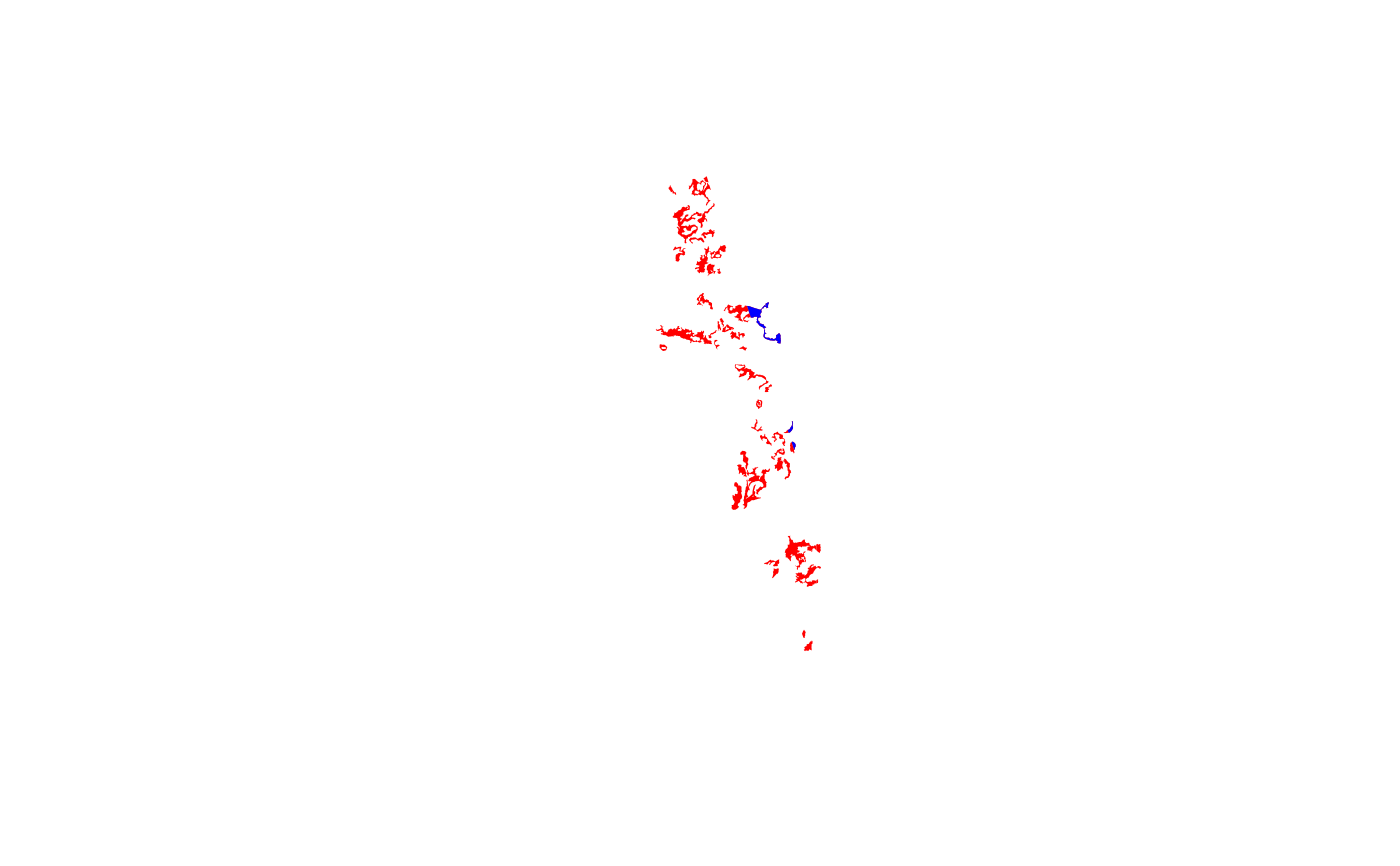
# demonstrate fetching full extent (multi-mukey) of national musym
full.extent.nmusym <- try(fetchSDA_spatial(x = "2x8l5", by = "nmusym"))
#> Using 1 chunks...
#> Chunk #1 completed (n = 3; 0.8 secs)
#> Done in 1 secs; mean/chunk: 0.8 secs; mean/symbol: 0.32 secs.
# compare extent of nmusym to single mukey within it
if (!inherits(single.mukey, 'try-error') &&
!inherits(full.extent.nmusym, 'try-error')) {
if (requireNamespace("sf")) {
plot(sf::st_geometry(full.extent.nmusym), col = "RED", border = 0)
plot(sf::st_geometry(single.mukey), add = TRUE, col = "BLUE", border = 0)
}
}
 # demo adding a field (`muname`) to attribute table of result
head(try(fetchSDA_spatial(x = "2x8l5", by="nmusym", add.fields="muname")))
#> Using 1 chunks...
#> Chunk #1 completed (n = 3; 0.5 secs)
#> Done in 0.7 secs; mean/chunk: 0.5 secs; mean/symbol: 0.23 secs.
#> Simple feature collection with 6 features and 4 fields
#> Geometry type: POLYGON
#> Dimension: XY
#> Bounding box: xmin: -121.034 ymin: 38.01706 xmax: -120.9596 ymax: 38.24938
#> Geodetic CRS: WGS 84
#> mukey areasymbol nationalmusym muname
#> 1 462101 CA077 2x8l5 Pentz-Bellota complex, 2 to 15 percent slopes
#> 2 462101 CA077 2x8l5 Pentz-Bellota complex, 2 to 15 percent slopes
#> 3 462101 CA077 2x8l5 Pentz-Bellota complex, 2 to 15 percent slopes
#> 4 462101 CA077 2x8l5 Pentz-Bellota complex, 2 to 15 percent slopes
#> 5 462101 CA077 2x8l5 Pentz-Bellota complex, 2 to 15 percent slopes
#> 6 462101 CA077 2x8l5 Pentz-Bellota complex, 2 to 15 percent slopes
#> geom
#> 1 POLYGON ((-121.0226 38.2276...
#> 2 POLYGON ((-121.0141 38.2325...
#> 3 POLYGON ((-121.0339 38.2325...
#> 4 POLYGON ((-120.9955 38.0674...
#> 5 POLYGON ((-121.0102 38.1891...
#> 6 POLYGON ((-120.9648 38.0208...
# }
# demo adding a field (`muname`) to attribute table of result
head(try(fetchSDA_spatial(x = "2x8l5", by="nmusym", add.fields="muname")))
#> Using 1 chunks...
#> Chunk #1 completed (n = 3; 0.5 secs)
#> Done in 0.7 secs; mean/chunk: 0.5 secs; mean/symbol: 0.23 secs.
#> Simple feature collection with 6 features and 4 fields
#> Geometry type: POLYGON
#> Dimension: XY
#> Bounding box: xmin: -121.034 ymin: 38.01706 xmax: -120.9596 ymax: 38.24938
#> Geodetic CRS: WGS 84
#> mukey areasymbol nationalmusym muname
#> 1 462101 CA077 2x8l5 Pentz-Bellota complex, 2 to 15 percent slopes
#> 2 462101 CA077 2x8l5 Pentz-Bellota complex, 2 to 15 percent slopes
#> 3 462101 CA077 2x8l5 Pentz-Bellota complex, 2 to 15 percent slopes
#> 4 462101 CA077 2x8l5 Pentz-Bellota complex, 2 to 15 percent slopes
#> 5 462101 CA077 2x8l5 Pentz-Bellota complex, 2 to 15 percent slopes
#> 6 462101 CA077 2x8l5 Pentz-Bellota complex, 2 to 15 percent slopes
#> geom
#> 1 POLYGON ((-121.0226 38.2276...
#> 2 POLYGON ((-121.0141 38.2325...
#> 3 POLYGON ((-121.0339 38.2325...
#> 4 POLYGON ((-120.9955 38.0674...
#> 5 POLYGON ((-121.0102 38.1891...
#> 6 POLYGON ((-120.9648 38.0208...
# }